Excerpt of my as of yet unpublished book covering the whole 65 kilometers of the Meuse river in the Province of Liège in 160 photos.
Introduction from the book:
All rivers have a story to tell. Not just of the places on their journeys from source to sea, but also of the ages they have seen – for they are older than anything on their banks, and have shaped the landscape itself. Over the centuries, they in turn have been modified to suit the needs of humans: as well as the earliest roads, they were also the borders that created the cultural divides and connections that exist to this day. And, of course, the unlimited supply of water has always been vital to farming and industry.
Outside England, the first region in the world to be industrialised in the early nineteenth century was in Belgium: that of Liège and Verviers. This had much to do with the presence of the Meuse and its tributaries, whose waters drove spinning and weaving machines and transported merchandise to the seaports.
After originating in Eastern France, the Meuse connects Liège to the Netherlands, where its confluence with the estuaries of the Rhine and Scheldt creates the enormous delta that has physically and culturally shaped the whole country. Born and brought up in that land of water, I have learned to appreciate rivers as wild things with lives of their own and as ribbons of the past running through the modern world. Even when the things on the bank are ugly and boring, their reflections in the water are often alive and fascinating. As a very different region of water, the Province of Liège has the Meuse, its tributary the Ourthe, with its own tributaries, the Vesdre and Amblève; and numerous canals and smaller streams. Four of these watercourses run through the agglomeration of Liège itself, past urban, industrial and natural scenery.
While many books and films have been made about or around great romantic rivers such as the Danube, Seine, or Rhine, and also about exotic rivers such as the Volga, Ganges, Nile and Amazon, I have never seen one on my favourite, the Meuse. But few people, including those who live near by, seem to stop and take a closer look at the Meuse valley in the Liège region, which is varied, dramatic and sometimes beautiful, despite accommodating the route of the E25 motorway for many kilometres.
In my view, the Meuse is a world-class river on a small scale, running past small-scale metropolises and mini-mountains, as well as through one of the flattest and wettest regions on earth. I also believe it’s at its best in Wallonia, where, in deep shades of blue, it reflects a varied landscape ranging from post-apocalyptic to paradisal – as well as the near-organic masses of buildings that make up the waterfront in the city of Liège.
To make these pictures, I have pushed my bike through the undergrowth next to motorways, have lifted it over fences, been stung by many nettles and scratched by many thorns, and have both got dirty and wet. And I’ve enjoyed every minute of it! But my main aim when starting to make this book was to capture and present the state of the city’s waterfronts in 2012, when the nineteenth century seems finally to be disappearing from this region. So sit back, take your time, and let the river take you on part of its journey!
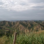
km 0,00 Andenne, Provine of Namur, 2012-09-09
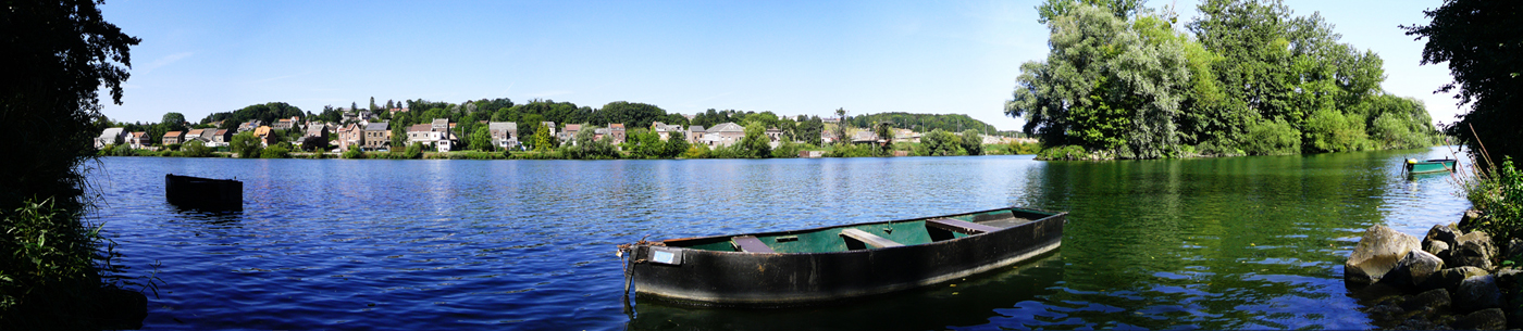
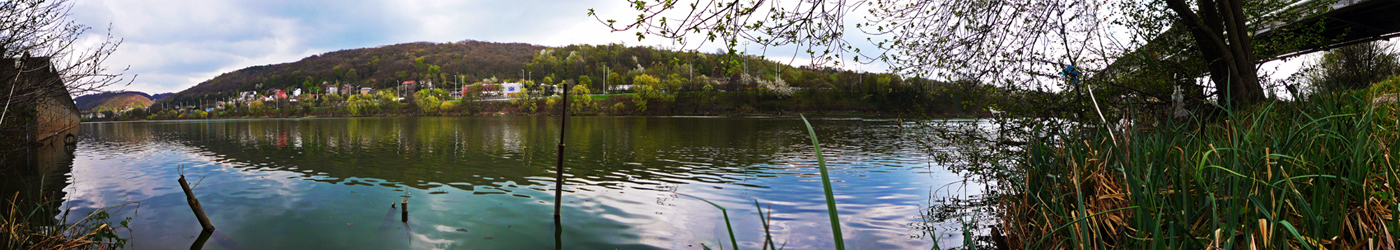
 km 8,2, Bas-Oha and the Ile du Bosquet, 2012-09-09
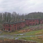
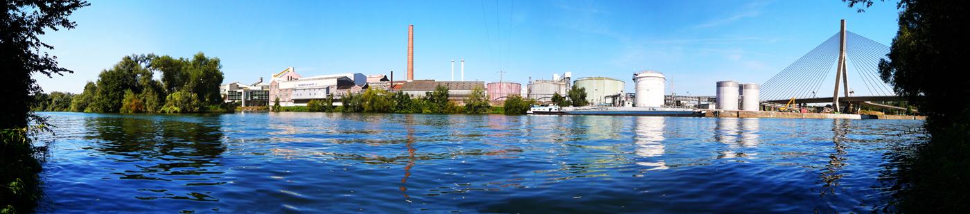
 km 9,2, Sugar factory at Wanze, 2012-09-09
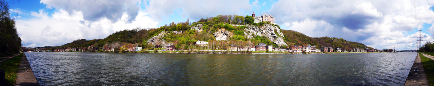
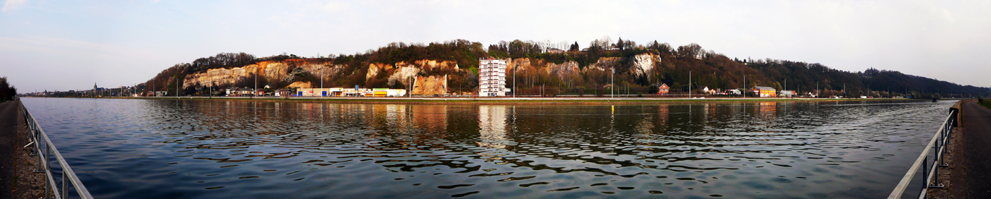
 km 11,7, Huy citadel, 2014-07-03
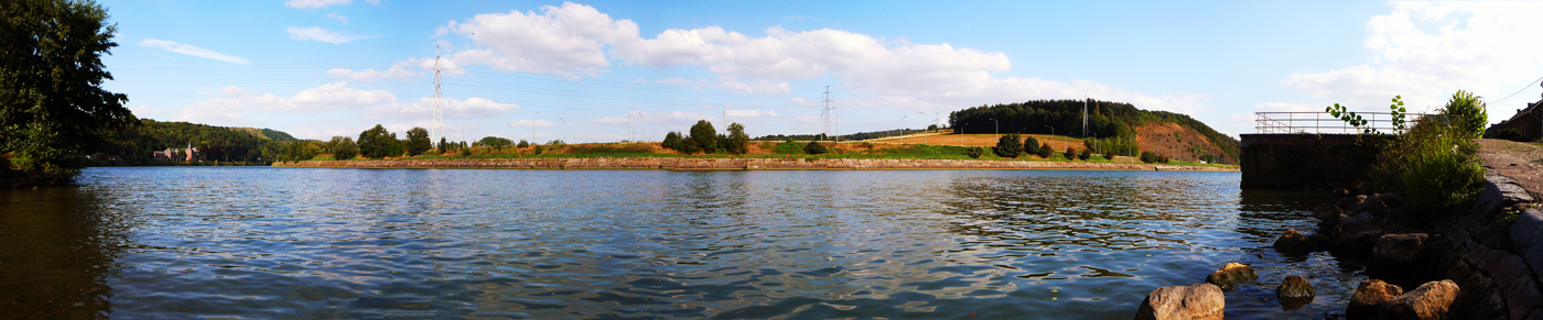
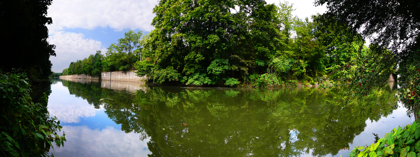
 km 21,2, Flône, 2012-09-05
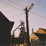
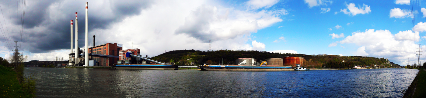
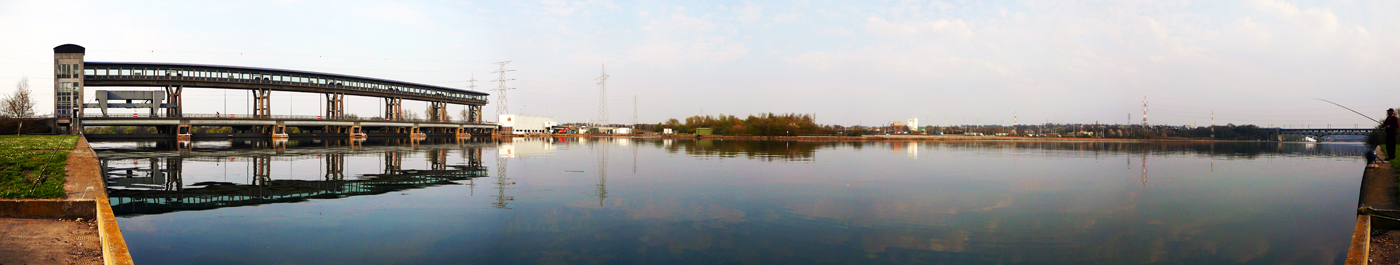
 km 29,1, Engis power station, 2012-04-22
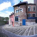
 km 29,9, Chokier castle, 2012-04-22
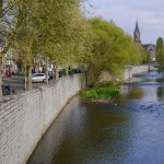
 km 34,6, Quai Jules Destrée, Seraing, 2012-04-22
 Cockeril iron foundry, Seraing, 2014-07-02
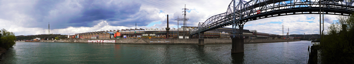
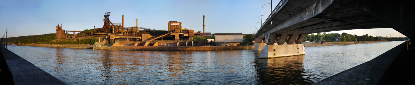
 km 37,8, Cockeril Jemeppe, 2012-04-11
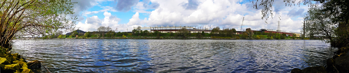
 Standard de Liège football stadium, 2012-04-11
 Cockeril Ougrée, 2014-07-03
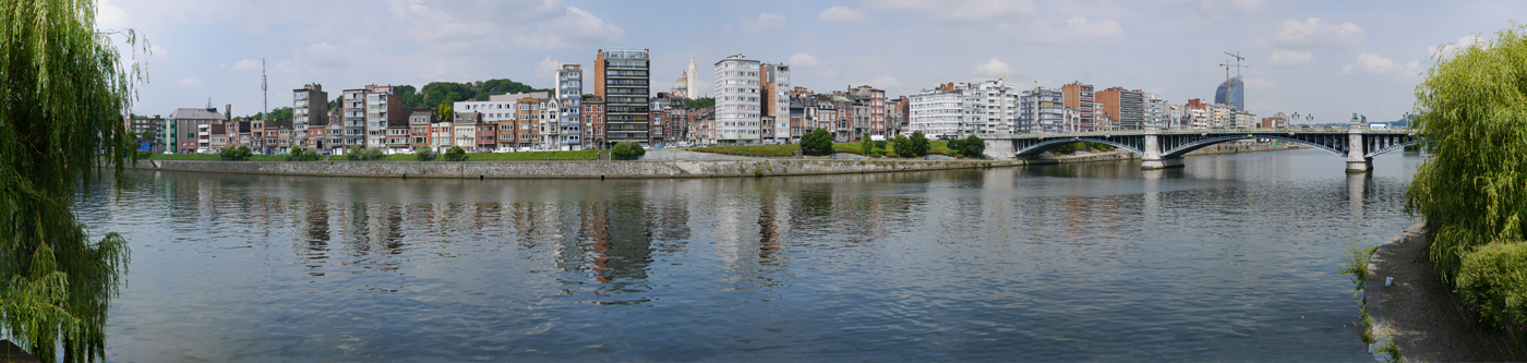
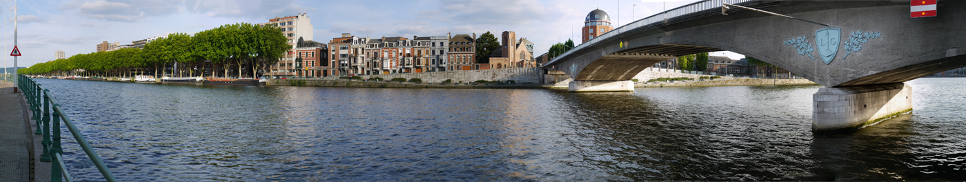
 km 42,4, Pont de Fragnée, Liège, 2014-06-24
 km 42,5, The split of the Meuse (left) and the Dérivation de la Meuse, which form the island containing the neighbourhood of Outremeuse before flowing together again at Droixhe, 2014-03-06
 km 43,2, View on the Dérivation de la Meuse from Parc de la Boverie, 2011-10-23
 Dérivation de la Meuse from Quai Bonaparte, 2012-03-27
 Passerelle footbridge, with Outremeuse on the opposite bank, 2011-10-24
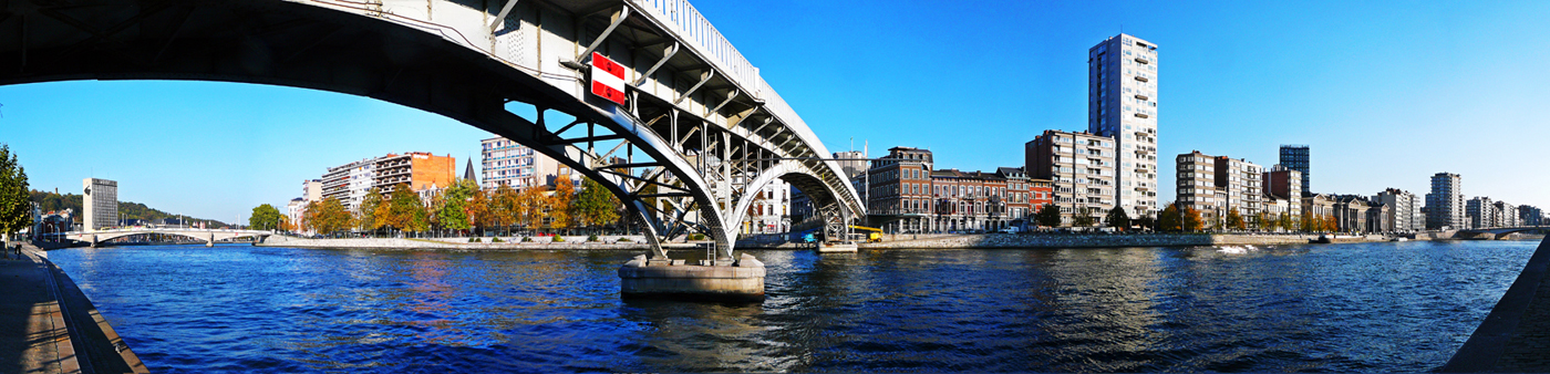 Pont Saint-Léonard with Outremeuse on the opposite bank, 2014-06-23
 Cité administrative and the neighbourhood of Hors-Château, seen from Outremeuse, 2011-10-24
 km 47,0, Pont de l ‘Atlas with Outremeuse on the opposite bank, 2012-04-12
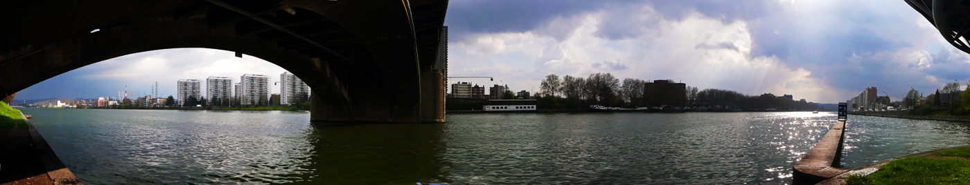 km 47,6, The split of the Meuse (top) and Albert Canal at the Ile Monsin, seen from the terril at Bernalmont, Herstal, 2014-06-23
 km 48,0, Ile Monsin (left), 2012-04-20
 km 46,2, Dérivation de la Meuse and the neighbourhood of Bressoux, 2013-06-04
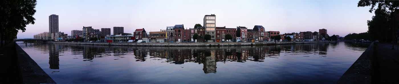 km 47,3, Droixhe seen from Coronmeuse, 2012-04-12
 km 49,8, View on the Meuse from Ile Monsin, 2012-04-12
 km 51,6, Ile Monsin seen from next to the E25 motorway, 2012-09-10
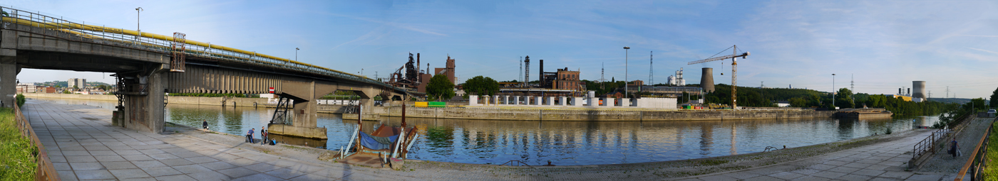
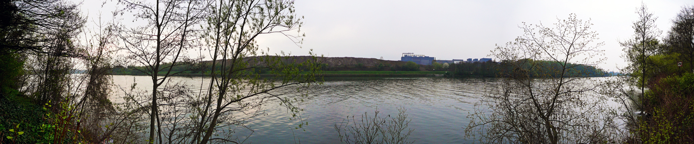
 km 54,1, Cockeril Chertal and the Meuse, 2012-04-14
 km 54,6, Dock of the Meuse in Cheratte, 2012-09-10
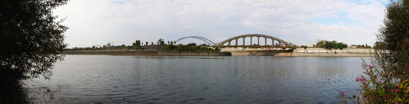
 km 54,4 km, Cockeril Chertal and the Albert Canal
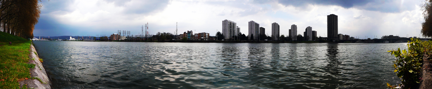
 km 59,2, Beginning of Visé, 2012-04-03
 km 62,2, Dam at Lixhe, 2012-04-03
 km 65,5, The Dutch Limburg village of Eijsden seen from Lanaye, 2012-04-03
 km 70,6, The lock of Lanaye, where the Maastricht Canal (right) splits from the Albert Canal. About 6 kilometers from Maastricht, 2012-02-05

Leave a Reply